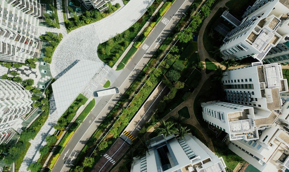
Aerial 3D rendering involves generating 3D imagery in an aerial view rendering studio after using a particular software to view a site, building, or an entire area from an aerial perspective. Whether a high building or an entire estate, aerial rendering can give the actual measurement and detailed image of every angle, irrespective of size.
These benefits go beyond geographical and landscape measurement. They also help professionals who use it showcase their projects most interestingly and appealingly. Thus, these experts can create a better atmosphere that allows them to explain their ideas, advantages, and design features and demonstrate the project’s success in a concrete and visually stimulating manner that would leave a good first impression on their clients.
As we have seen, aerial view rendering can greatly impact the entire project scope and affect clients’ decision-making. Let us now look at its practical uses.
Practical Uses of Aerial 3D Rendering
Aerial view rendering is used mostly by urban planners, engineers, transporters, real estate agents, and others. However, we will look at a few of them and how they use it below.
Urban Planning and Development
One useful tool for urban planning is an aerial view rendering. Urban planners find this tool useful because it allows them to visualize land use and prepare for potential issues. Planners can predict possible problems like traffic jams or flood danger by giving precise measurements and views of every aspect of a working project. This kind of view promotes more sustainable urban development and helps make smarter decisions.
Real Estate Marketing
Real estate agents also find aerial view rendering useful, as it assists them in promoting homes and provides potential buyers or tenants with a full perspective of the surrounding neighborhood, including amenities, infrastructure, and natural elements. This improved perspective is very useful for displaying massive structures or residences in attractive places.
Furthermore, these renderings help determine the prospective views from various structure floors, allowing buyers to make more informed decisions about real estate investments.
Environmental Management
Environmental management also greatly benefits from 3D aerial view rendering services. These services help handle environmental crises promptly and precisely by gathering data on various environmental characteristics, including vegetation health, soil erosion, water quality, and habitat mapping. This can reduce the intensity of environmental crises and minimize their impact on ecosystems and populations.
Transportation
Aerial view rendering is used for traffic control and route planning in the transportation industry. Airports, railroads, and other transportation networks are all designed and optimized with the help of these designs. It is possible to monitor and control traffic flow more effectively, pinpointing areas of traffic jams and making plans for remedies. This technology helps travelers and logistical operations alike by improving mobility and cutting down on journey time.
Construction and Engineering
3D aerial view rendering services are extremely useful for site investigation, project planning, and progress tracking in the construction and engineering industries. For instance, engineers use these services to evaluate the environment, spot potential hazards, and arrange the logistics of transporting equipment and supplies before construction even begins. This will allow them to track their building project effectively. Engineers can track their building process, cut down expenses, and ensure that projects stay within budget and meet deadlines.
Architecture
Apart from the transportation and construction industry, another useful aerial view rendering can be used in the architectural industry. Architects use this tool to visualize their design in a real environment. This image assists in determining how a new structure is viewed from its surroundings, taking into account scale, architectural harmony, and environmental effects. Such extensive previews are useful during client presentations since they provide a concrete depiction of the project, making it easier to grasp and approve.
Bottom Line
This article has shared the benefits of aerial 3D rendering and highlighted its practical uses in everyday life. So, it is yours to explore! However, these benefits may not be fully achieved without the help of a company offering 3D aerial view rendering services to gain more insight into how to use it efficiently and effectively.


